Content
April 1, 2021. Warm sunny weather greets us at the start of the month.
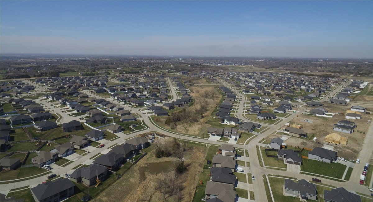
The landscape is starting to turn green. Photo, Ken Dewey, 300 feet over Lincoln, NE
Related Links:
Last month's Data: March 2021
Next month's Data: May 2021
Lincoln's snowfall climatology
Winter 2020-21 (and last 2 years) Snowfall (in inches) compared to normal.
| OCT | NOV | DEC | JAN | FEB | MAR | APR | MAY | TOTAL | |
| Normal | 0.7 | 2.1 | 5.9 | 5.4 | 5.6 | 4.8 | 1.4 | 0.0 | 25.9 |
| 2020-21 | 2.9 | T | 11.0 | 18.9 | 16.6 | 0.0 | T | 49.4 | |
| 2019-20 | 0.7 | 1.7 | 1.8 | 5.5 | 1.6 | 1.5 | 4.8 | 0.0 | 17.6 |
| 2018-19 | 3.5 | 7.2 | 5.6 | 9.7 | 23.2 | 6.3 | T | 0.0 | 55.5 |
T = a Trace. Snowfall was observed but not enough to be measured
Year 2021 (and last year) Lincoln Precipitation in Inches compared to normal
| JAN | FEB | MAR | APR | MAY | JUN | JUL | AUG | SEP | OCT | NOV | DEC | TOTAL | |
| Normal | 0.64 | 0.77 | 1.93 | 2.71 | 4.29 | 4.34 | 3.40 | 3.48 | 3.02 | 1.97 | 1.43 | 0.95 | 28.93 |
| 2021 | 1.53 | 0.79 | 5.23 | 1.74 | . | . | . | . | . | . | . | . | 9.29 |
| 2020 | 1.29 | 0.13 | 1.67 | 0.88 | 5.09 | 3.15 | 5.73 | 1.27 | 1.62 | 0.40 | 1.20 | 1.20 | 23.63 |
Normal Precipitation total January 1 - April 30: 6.05 inches
Tied record low, April 1, 2021 at 17°F, record first set April 1, 1899.
Record daily precipitation April 8, 2021, 0.86 inches, old record 0.85 inches set in 1922.
Record low, April 22, 23°F, old record 25°F set in 1992
LINK: Climatology of last freeze after winter
ANNOUNCEMENTS:
Weatherfest Saturday April 10, 2021 is CANCELLED
UNL National Weathercamp scheduled for June 2021 is CANCELLED
All data in the following table are from the National Weather Service and HPRCC data archives.
If columns are hidden, scroll the table right.
| April | 2021 | Max | Min | Mean | Dep | Pcpn | Rec Pcpn | Rec Max | Rec Min | HDD | CDD | Norm Max | Norm Min | Norm Mean | Snow |
|---|---|---|---|---|---|---|---|---|---|---|---|---|---|---|---|
| Thursday | Apr. 1 | 59 | 17 | 38 | -8 | 0.00 | 0.67 | 91 | 17 | 27 | 0 | 59 | 33 | 46 | . |
| Friday | Apr. 2 | 76 | 39 | 58 | +11 | 0.00 | 1.45 | 90 | 11 | 7 | 0 | 60 | 34 | 47 | . |
| Saturday | Apr. 3 | 81 | 42 | 62 | +15 | 0.00 | 1.35 | 88 | 3 | 3 | 0 | 60 | 34 | 47 | . |
| Sunday | Apr. 4 | 89 | 47 | 68 | +21 | T | 1.00 | 94 | 13 | 0 | 3 | 60 | 34 | 47 | . |
| Monday | Apr. 5 | 85 | 57 | 71 | +23 | T | 1.20 | 89 | 12 | 0 | 6 | 61 | 35 | 48 | . |
| Tuesday | Apr. 6 | 76 | 59 | 68 | +20 | 0.07 | 0.79 | 91 | 12 | 0 | 3 | 61 | 35 | 48 | . |
| Wednesday | Apr. 7 | 65 | 46 | 56 | +8 | 0.43 | 0.98 | 87 | 16 | 9 | 0 | 61 | 35 | 48 | . |
| Thursday | Apr. 8 | 52 | 41 | 47 | -2 | 0.86 | 0.86 | 88 | 17 | 18 | 0 | 62 | 36 | 49 | . |
| Friday | Apr. 9 | 65 | 36 | 51 | +2 | 0.09 | 1.92 | 90 | 20 | 14 | 0 | 62 | 36 | 49 | . |
| Saturday | Apr. 10 | 64 | 34 | 49 | -1 | 0.00 | 1.66 | 92 | 17 | 16 | 0 | 63 | 37 | 50 | . |
| Sunday | Apr. 11 | 70 | 29 | 50 | 0 | 0.00 | 0.96 | 93 | 20 | 15 | 0 | 63 | 37 | 50 | . |
| Monday | Apr. 12 | 61 | 41 | 51 | +1 | 0.00 | 1.03 | 86 | 17 | 14 | 0 | 63 | 37 | 50 | . |
| Tuesday | Apr. 13 | 58 | 31 | 45 | -6 | 0.00 | 1.78 | 89 | 15 | 20 | 0 | 64 | 38 | 51 | . |
| Wednesday | Apr. 14 | 52 | 27 | 40 | -11 | 0.00 | 2.75 | 91 | 16 | 25 | 0 | 64 | 38 | 51 | . |
| Thursday | Apr. 15 | 54 | 26 | 40 | -11 | 0.00 | 0.92 | 93 | 16 | 25 | 0 | 64 | 39 | 51 | . |
| Friday | Apr. 16 | 45 | 37 | 41 | -11 | 0.17 | 1.52 | 91 | 21 | 24 | 0 | 65 | 39 | 52 | . |
| Saturday | Apr. 17 | 54 | 42 | 48 | -4 | 0.08 | 1.59 | 90 | 20 | 17 | 0 | 65 | 39 | 52 | . |
| Sunday | Apr. 18 | 64 | 43 | 54 | +2 | 0.00 | 1.40 | 94 | 21 | 11 | 0 | 65 | 40 | 52 | . |
| Monday | Apr. 19 | 48 | 31 | 40 | -13 | 0.04 | 1.54 | 92 | 25 | 25 | 0 | 66 | 40 | 53 | T |
| Tuesday | Apr. 20 | 51 | 32 | 42 | -11 | T | 1.93 | 95 | 20 | 23 | 0 | 66 | 41 | 53 | . |
| Wednesday | Apr. 21 | 49 | 29 | 39 | -15 | 0.00 | 1.37 | 92 | 24 | 26 | 0 | 66 | 41 | 54 | . |
| Thursday | Apr. 22 | 59 | 23 | 41 | -13 | 0.00 | 1.40 | 94 | 23 | 24 | 0 | 67 | 41 | 54 | . |
| Friday | Apr. 23 | 66 | 45 | 56 | +2 | 0.00 | 1.73 | 89 | 26 | 9 | 0 | 67 | 42 | 54 | . |
| Saturday | Apr. 24 | 64 | 38 | 51 | -4 | 0.00 | 2.60 | 94 | 22 | 14 | 0 | 67 | 42 | 55 | . |
| Sunday | Apr. 25 | 78 | 47 | 63 | +8 | 0.00 | 2.20 | 92 | 28 | 2 | 0 | 68 | 43 | 55 | . |
| Monday | Apr. 26 | 92 | 60 | 76 | +21 | 0.00 | 1.28 | 97 | 27 | 0 | 11 | 68 | 43 | 55 | . |
| Tuesday | Apr. 27 | 79 | 53 | 66 | +10 | T | 1.58 | 95 | 24 | 0 | 1 | 68 | 43 | 56 | . |
| Wednesday | Apr. 28 | 67 | 51 | 59 | +3 | T | 2.34 | 97 | 30 | 0 | 6 | 69 | 44 | 56 | . |
| Thursday | Apr. 29 | 76 | 42 | 59 | +3 | 0.00 | 1.85 | 93 | 27 | 0 | 6 | 69 | 44 | 56 | . |
| Friday | Apr. 30 | 88 | 41 | 65 | +8 | 0.00 | 1.24 | 90 | 25 | 0. | 0 | 69 | 45 | 57 | . |
| April | 2021 | Max | Min | Mean | Dep | Pcpn | Rec Pcpn | Rec Max | Rec Min | HDD | CDD | Avg Max | Avg Min | Avg Mean | Snow |
| . | TOTAL | 1.74 | 380 | 24 | T | ||||||||||
| . | AVERAGE | 66.2 | 39.5 | 52.9 | |||||||||||
| NORMAL | 64.3 | 38.8 | 51.6 | 2.71 | 416 | 13 | 1.4 | ||||||||
| . | DEPARTURE | +1.9 | +0.7 | +1.3 | -0.97 | -36 | +11 | -1.4 |
AVERAGE AND TOTAL are APRIL 2021.
Temperature is °F
Precipitation measurement is "inches"
Precipitation "T" = trace, precipitation was observed but not enough to be measured
NORMAL (Norm) refers to the 1981-2010 Standard Normals
DEPARTURE is APRIL 2021 Average measured against 1981-2010 normals, °F.
Max = Observed Maximum and Min = Observed Minimum temperatures in °F.
Mean = Observed Mean Daily temperature in °F.
Dep = Departure from normal ( __ = below normal, + above normal), in °F.
Pcpn = Observed daily precipitation (midnight to midnight, CST) in inches.
Rec Pcpn = Record daily amount of precipitation in inches.
Rec Max = Record maximum temperature in °F.
Rec Min = Record Minimum temperature in °F.
HDD = Heating Degree Day units (base of 65 degrees) in °F.
CDD = Cooling Degree Day units (base of 65 degrees) in °F.
Norm Max = Daily Normal High Temperature (1981-2010 normals) in °F.
Norm Min = Daily Normal Low Temperature (1981-2010 normals) in °F.
Norm Mean = Daily Normal Mean Temperature (1981-2010 normals) in °F.
Snow = Snowfall in inches.
From the record books:
Warmest recorded APRIL temperature, 97°F, April 26, 1989; April 28, 1910.
Coldest recorded APRIL temperature, 3°F, April 3, 1975.
SNOWFALL: 122 Years (1900 - 2021)
Most APRIL Snowfall: 11.1 inches, 1997.
In the last 122 years, 1900 - 2021, April had measurable snowfall 57 times (47% of the years)
In the last 122 years, 1900 - 2021, April had no measurable snowfall 65 times (53% of the years)
A Trace (T) of snowfall means snowfall was observed, but not enough to measure, i.e. it is not measurable.
NOTE: All data on this page are from the National Weather Service and HPRCC data archives.