Content
RETURN to the U.S. and Nebraska Tornadoes Page
F Scale vs EF Scale
The Fujita Scale (F0 to F5) had been traditionally used to classify tornado damage.
More recently, the new Enhanced Fujita Scale (EF0 to EF5) has been used.
For consistency, the maps here are labeled (E)F Scale. In practice, for example, an EF3 tornado is considered to be the equivalent of an F3 tornado for mapping purposes.
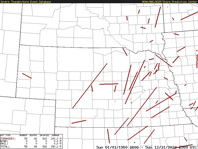
The following maps were generated by an on-line program, "Severe Plot", located at the Storm Prediction Center. The data in this archive runs from 1950 thru 2023 and has not been updated beyond 2023 at this time (January 2025). The data archive is updated annually, by mid-year, after all the recent data are thoroughly verified. Preliminary vs final tornado counts. The Year 2024 data will be available for mapping later this year (Summer or Fall 2025).
The map coverage extends slightly beyond the Nebraska borders since the program does not allow isolating an individual state.
Severe Plot Map is centered on latitude=41.298 & longitude=99.900 & zoom=200.
There are seven maps: (E)F0; (E)F1; (E)F2; (E)F3; (E)F4; (E)F5 tornadoes AND, All Tornadoes (E)F0-(E)F5 for the period 1950 thru 2023 and centered on Nebraska.
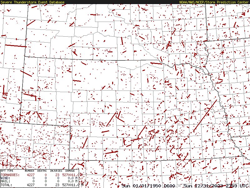
(E)F0 Tornadoes 1950-2023
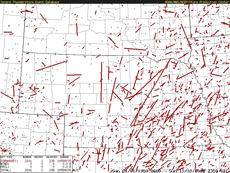
(E)F1Tornadoes 1950-2023
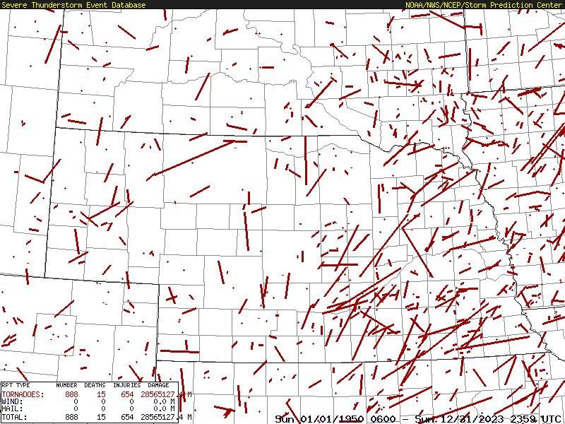
(E)F2 Tornadoes 1950-2022
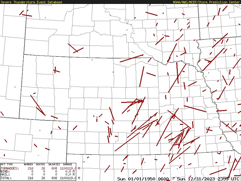
(E)F3 Tornadoes 1950-2023
(E)F4 Tornadoes 1950-2023
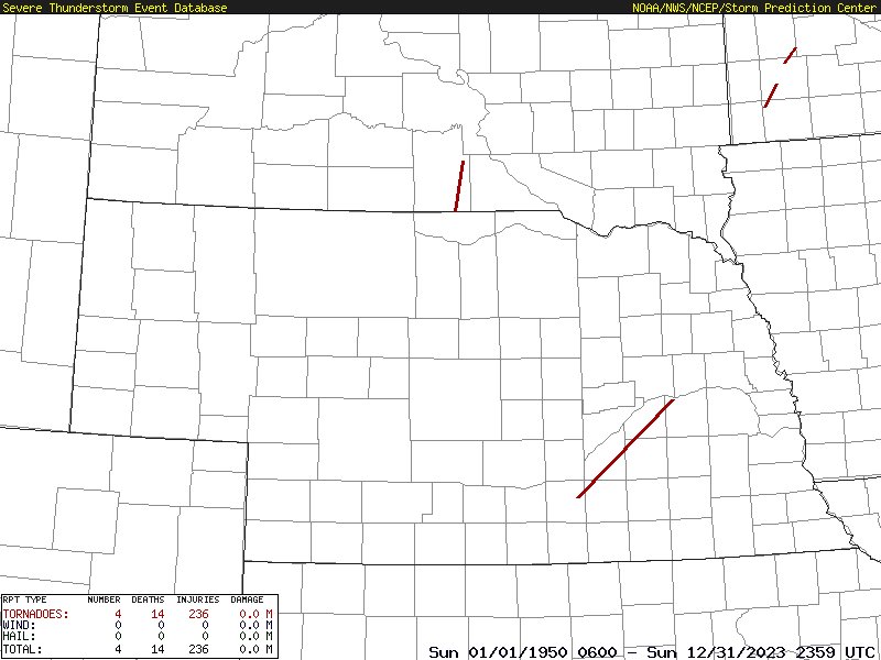
(E)F5 Tornadoes 1950-2023
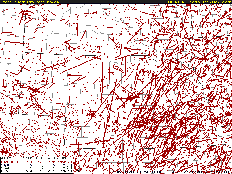
(E)F1 thru (E)F5, All Tornadoes 1950-2023