RETURN to the U.S. and Nebraska Tornadoes Page
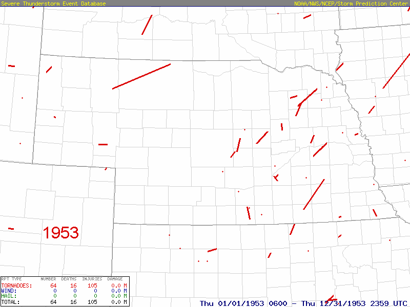
These maps were created using the SPC Severe Plot Program and then animated using Paint Shop Pro
It covers 1953 thru 2018. The data 2019 thru 2022 data are available at this time but I will not be udpating this animation for awhile (it is a lengthy process!).
Please note that not all tornadoes in the archive have paths that are visible on the maps.
Red dots appear that indicate that a tornado occurred at that location but there was no documented path.
Or the red dots are paths that are so short, just a few miles in length, and don't show up on a map at this scale.
Go below the animated maps to see an example.
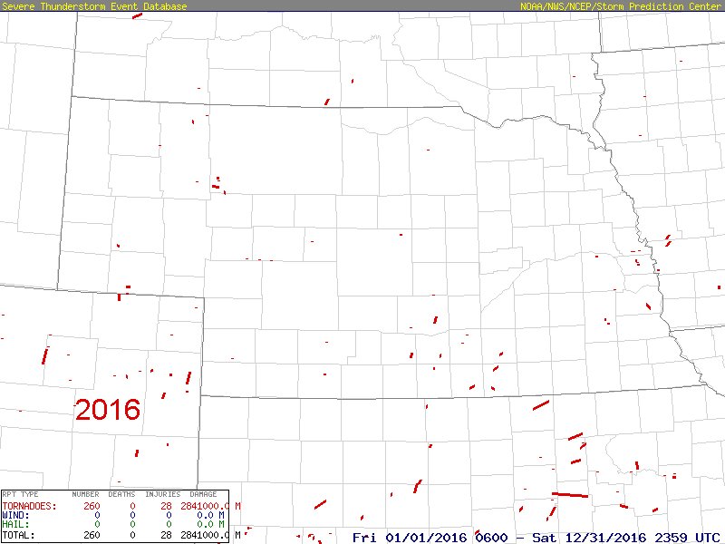
Note in the example below, the map of 2016 tornadoes, that there are two red dots in Lancaster County.
Note the next map after that which is zoomed in on Lancaster county and you can see two very short paths for F-1 tornadoes.
Actual path length and more information can be found at the bottom of this page.
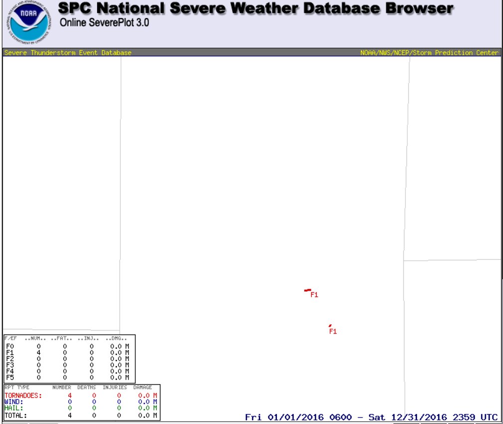
NWS Omaha Information about these two tornadoes: LINK
PUBLIC INFORMATION STATEMENT
NATIONAL WEATHER SERVICE OMAHA/VALLEY NE
121 PM CDT WED MAY 11 2016...

...NWS DAMAGE SURVEY FOR MAY 09, 2016 TORNADO EVENT...

...LINCOLN TORNADO #1 IN LANCASTER COUNTY...

EF SCALE RATING:        EF-1
ESTIMATED PEAK WIND:    100 MPH
PATH LENGTH /STATUTE/:  0.59 MILES
PATH WIDTH /MAXIMUM/:   100 YARDS
FATALITIES:             0
INJURIES:               0

START DATE:             MAY 9, 2016
START TIME:             TO BE DETERMINED
START LOCATION:         40.7365, -96.6106


END DATE:               MAY 9, 2016
END TIME:               TO BE DETERMINED
END LOCATION:           40.7364, -96.6208

MOST OF THE DAMAGE WAS LOCATED SOUTH OF PINE LAKE.
..NWS DAMAGE SURVEY FOR MAY 09, 2016 TORNADO EVENT...

...LINCOLN TORNADO #2 IN LANCASTER COUNTY...

EF SCALE RATING:        EF-1
ESTIMATED PEAK WIND:    100 MPH
PATH LENGTH /STATUTE/:  0.2 MILES
PATH WIDTH /MAXIMUM/:   100 YARDS
FATALITIES:             0
INJURIES:               0

START DATE:             MAY 9, 2016
START TIME:             4:53 PM CDT
START LOCATION:         40.6946, -96.5830


END DATE:               MAY 9, 2016
END TIME:               4:56 PM CDT
END LOCATION:           40.6971, -96.5813